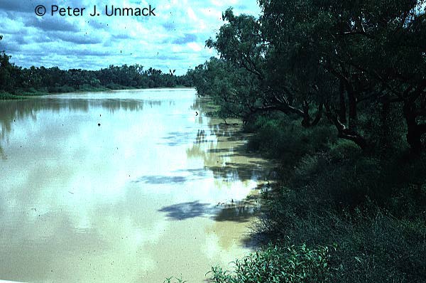
Rivers in central Australia are unusual in that they all rise in the arid zone and end in the arid zone In most of the world, desert rivers enter from humid areas. There is no permanent flowing water in any waterways except springs. Central Australia does not have a wet and a dry season. However, large storms tend to be more common in summer when the occasional remnants of tropical cyclones drift over central Australia. Australian rivers are up to 1000 times more variable in mean annual discharge than most European and North American rivers (Gale & Bainbridge 1990). The only occasion that stream flow occurs is after rainfall events. In small catchments streamflows are relatively short, perhaps a few hours to a few days. At any one site on a larger river, flow typically lasts for a few days to a few weeks; flows lasting greater than one month are rare. Streamflow tends to travel slowly along the length of the river; Cooper Creek for example has gradients as low as 1.9cm/km (1.3in/mi). Thus, it may take one or two months for the water in the upper reaches to get to the lower reaches. When in flood, rivers such as Cooper Creek may spread as wide as 50km. Most rivers contain very little permanent water. All the water exists in a series of waterholes, most of which disappear after a year or two with no flow. What little physiochemical data exists demonstrates that most waterbodies have very broad temperature and salinity ranges (Glover 1982). Doddridge (1992), working in the lower Cooper Creek recorded an annual temperature range of 13 to 34°C (56-93°F). Turbidity, caused by fine clay particles, is typically exceptionally high.
Australia is divided up into twelve major drainage divisions, three of these are found in central Australia (see map at the end of this item). The following is a short summary of each.
A map of the Bulloo-Bancannia Drainage Division is at the end of the item. The Bulloo-Bancannia Drainage Division is approximately 100,570km˛ (36,200mi˛). It consists of the Bulloo River system which terminates in Bulloo Lake; a series of large ephemeral swamps on the Queensland-New South Wales border. The Bancannia system consists of a series of small isolated creeks and lakes which remain poorly sampled. The Bulloo River is also poorly explored; most fish are known only from a few specimens. Curiously, the Bulloo River's fish populations are far less abundant than expected compared to other central Australian rivers. This may be due to much higher turbidity levels in the Bulloo River relative to other central Australian rivers. Previous authors have considered that the Bulloo River is, or was, part of the Murray-Darling Drainage Division (Lake 1971; Llewellyn & Pollard 1980). This is incorrect. The present land topography indicates that the most likely place for historical drainage to occur is towards Lake Frome. The fish fauna of the Bulloo River also most closely resembles that of Cooper Creek, which had past connections to Lake Frome.
Waterhole in the Bulloo River, Thargomindah, Queensland. Western carp gudgeons were most abundant here along with smaller numbers of Midgley's carp gudgeons, Bulloo yellowbelly, spangled perch, and silver tandan.
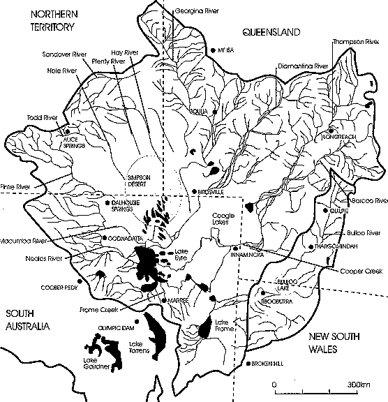
A map of the Lake Eyre Drainage Division is at the end of the item. The Lake Eyre Drainage Division is approximately 1,300,000km˛ (468,000mi˛) in area and only thirty percent of its area is higher than 250m (800ft) above sea level. Lake Eyre is the terminus for all the drainage. It lies -15.2m (-50ft) below sea level (Kotwicki 1989).
Despite the relatively long and large size of the rivers, permanent water is quite limited in extent. For example, the Neales River is reported to have two permanent waterholes. The Macumba, Finke, Todd, Hale Rivers and all of the Frome System have no permanent waterholes, while the Plenty and Hay Rivers only have a couple of tiny springfed pools. The Georgina River has only one waterhole which has not dried since European settlement, although there are many which usually have water present (Randal 1978). The Diamantina River has quite a few permanent waterholes, and Cooper Creek has the greatest number and not surprisingly the highest fish diversity, although it also occurs in the least arid area.
Despite the appearance on a map that most of the larger rivers connect to Lake Eyre, the lake appears to act as a physical barrier to migration by some fish species. Most of the rivers that contribute water to Lake Eyre each have a distinctive fish fauna. For instance, several species are endemic to Cooper Creek while the Diamantina River has no endemic species. Both rivers occasionally flow into Lake Eyre at the same time. There are no obvious reasons why the Cooper Creek endemics couldn't survive in the Diamantina River today. Although data is lacking on what lives in the lake, when it contains water most species can access the lake during floods. Also, the lake habitat is not that different to their usual habitat. Nobody really knows why the endemics don't cross between the rivers.
Waterhole in Aramac Creek, Aramac, Queensland. Australian smelt, bony bream, Hyrtl's catfish, desert rainbowfish, western chanda perch, spangled perch, western and Midgley's carp gudgeon, and damnbusia were collected here.
"Permanent" waterhole in the Thompson River, Longreach, Queensland. 13 native, 2 exotic, and one translocated species can be found here. Australian smelt, bony bream, Hyrtl's catfish, Cooper Creek catfish, silver tandan, desert rainbowfish, western chanda perch, Lake Eyre yellowbelly, Welch's grunter, Barcoo grunter, spangled perch, western and Midgley's carp gudgeon, damnbusia, goldfish and Murray cod. It makes for a wonderful fishing hole after rains.
"Permanent" waterhole in the Darr River, Cooper system, Queensland. Peter Unmack photo. Ditto above for the species list.
A typical ephemeral waterhole in the bed of the Thompson River just downstream of Longreach, Queensland. It was dry two months later.
A short haul of the seine net in the above waterhole provided this catch. Over 5000 fish were present.
Ephemeral waterhole on the upper Barcoo River, Cooper system, Tambo, Queensland. It's fish populations vary. Western, Midgley's, and Lake's (?) carp gudgeons are usually present. Also found less regularly are spangled perch, bony bream, and desert rainbowfish.
The same pool around 18 months without rainfall. Three species of carp gudgeon are still present.
Barcoo River, Cooper system, Blackall, Queensland. This waterhole is maintained by run-off from the township. Bony bream, desert rainbowfish, western chanda perch, Lake Eyre yellowbelly, Barcoo grunter, spangled perch, western, Midgley's, and Lakes (?) carp gudgeon have been captured here.
Avington waterhole, "permanent", upper Barcoo River, Queensland. 14 native species, one exotic. Australian smelt, bony bream, Hyrtl's catfish, Cooper Creek catfish, silver tandan, desert rainbowfish, western chanda perch, Lake Eyre yellowbelly, Welch's grunter, Barcoo grunter, spangled perch, western, Midgley's, Lake's (?), carp gudgeon, and damnbusia [which have only recently managed to migrate this far upstream, they are yet to be recorded the 50 or so km upstream at Blackall (30mi)]. It makes for a wonderful fishing hole after rains.
Waterhole in the Alice River, Barcaldine, Queensland. Australian smelt, bony bream, Hyrtl's catfish, desert rainbowfish, western chanda perch, spangled perch, western and Midgley's carp gudgeon, and damnbusia were collected here.
Ephemeral waterhole in Cooper Creek, Innamincka, South Australia. Stan Unmack photo. The river is still barely flowing. 13 native species, 2 exotic. Australian smelt, bony bream, Hyrtl's catfish, Cooper Creek catfish, silver tandan, desert rainbowfish, western chanda perch, Lake Eyre yellowbelly, Welch's grunter, Barcoo grunter, spangled perch, western, and Midgley's, carp gudgeon, damnbusia, and goldfish have all been recorded from this general vicinity.
Diamantina River in flow, near Winton, Queensland. Peter Unmack photo. This site only retains water for short periods after rainfall. Silver tandans were common, a couple of bony bream and spangled perch were also collected.
The typical scene on the Diamantina River channels, near Winton, Queensland.
Rainfall in central Australia can be very intense. Overland flow such as this can provide fish with short periods of time to migrate to new habitats.
"Permanent" waterhole on the Burke River, Georgina system, Boulia, Queensland. All 11 native species that occur in the Georgina River System were recorded. No exotics are present. Bony bream, Hyrtl's catfish, silver tandan, desert rainbowfish, western chanda perch, Lake Eyre yellowbelly, Welch's grunter, Barcoo grunter, spangled perch, banded grunter, and flathead goby It was a great fishing hole as the river started flowing the second day I was there. We averaged a catfish every ten minutes or less once it started flowing!
View across the Plenty River. The river's channel varies between about 1-2km across (0.6-1.2mi). Two months earlier 2.8m (9ft) depth of water was flowing through here. The river is still flowing but only through the sand. Where water exists spangled perch persist.
The Hale River at Ruby Gap Gorge east of Alice Springs. No permanent waterholes exist. It is the largest river within the Lake Eyre drainage that is deviod of fish. This had 2-3m (7-10ft) of water through only two months before. The river is still barely flowing mainly through vehicle tire tracks. The only way to get into this site is drive up the river bed.
Trephina Gorge east of Alice Springs. Spangled perch are present in the waterhole. One spot live bearers were once recorded here in 1974.
A drying waterhole in Atnarpa Creek east of Alice Springs, Northern Territory. Atnarpa Creek had flowed around two months prior this photo. The waterhole teemed with several thousand spangled perch which in the only species found in the Todd River System. Maximum depth was 0.6m (2ft). It would not have retained water for more than a couple of months after.
One of the few large deep "permanent" waterholes in the Finke River upstream of Glen Helen Gorge, west of Alice Springs, Northern Territory. All 9 native species known from the Finke River System were collected. No exotics are present. Bony bream, Hyrtl's catfish, desert rainbowfish, Finke hardyhead, western chanda perch, spangled perch, banded grunter, Finke mogurnda, and Finke goby. Depth at the edge of the reeds is about 1.8m (6ft). The Finke River is thought to have followed the same course for up to 350 million years.
A shallow patch at the end of the above waterhole. This is habitat that appears to be typically inhabitated by Finke mogurndas and Finke gobies as few could be collected elsewhere.
The Steavonson River, a typical Australian desert river, dry!
Algebuckina Waterhole in the Neales River. One of only two "permanent" waterholes within this river. Bony bream, Lake Eyre hardyheads, desert rainbowfish, spangled perch, desert gobies, and damnbusia. Catfish were reported after the 1974 floods, however they were unable to persist.
The Western Plateau Drainage Division is around 2,455,000km˛ (883,800mi˛ and is mostly between 450 and 600m (1,475 and 1,970ft) above see level. Its fish are very poorly known, especially in Western Australia. This is primarily because most of it is inaccessible due to a lack of roads. It consists of a series of now fragmented drainages (Van De Graaff et. al. 1977). No major rivers exist, and permanent water is apparently scarce. Despite the lack of water and collecting, spangled perch have been recorded at least once from all but two drainages.
Doddridge, L. K. 1992. The autecology of the Cooper Creek tortoise, Emydura sp (aff. krefftii). Unpublished dissertation, graduate diploma in science, University of New England, Armidale, New South Wales, Australia.
Gale, S. J. & Bainbridge, S. 1990. The floods of Eastern Australia. Nature. 345: 767.
Glover, C. J. M. 1982. Adaptations of fishes in arid Australia. In, Evolution of the Flora and Fauna of Arid Australia. Eds. Barker, W. R. & Greenslade, P. J. M., pp 241-246. Peacock Publications, Adelaide.
Kotwicki. V. 1989. Floods in the Western Lake Eyre Basin and their impact on Dalhousie Springs. In, Natural History of Dalhousie Springs. Eds. Zeidler, W. & Ponder, W. F. South Australian Museum, Adelaide. pp 41-46.
Lake, J. S. 1971. Freshwater Fishes and Rivers of Australia. Thomas Nelson Australia Ltd, Melbourne. 61pp.
Llewellyn, L. C. & Pollard, D. A. 1980. Family Plotosidae. In, Freshwater Fishes of South-eastern Australia. Ed. McDowell, R. M. Reed, Sydney. Pp91-93.
Randal, M. A. 1978. Hydrogeology of the South-Eastern Georgina Basin and environs, Queensland and Northern Territory. Geological Survey of Queensland, Publication No. 366.
Van De Graaff, W. J. E., Crowe, R. W. A., Bunting, J. A. & Jackson, J. 1977 Relict early Cainzoic drainage's in arid Western Australia. Zeitschrift fur Geomorphologie. 21(4): 379-400.
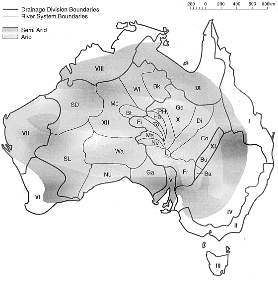
I=North-East Coast II=South-East Coast III=Tasmanian IV=Murray-Darling
V=South Australian Gulf VI=South-West Coast VII=Indian Ocean VIII=Timor Sea
IX=Gulf of Carpentaria X=Lake Eyre XI=Bulloo-Bancannia XII=Western Plateau
Ba=Bancannia system bk=Barkley system Bt=Burt system
Bu=Bulloo River system Co=Cooper Creek system Di=Diamantina River system
Fi=Finke River system Fr=Frome River system Ga=Gairdner system
Ge=Georgina River system Ha=Hale River system Ma=Macumba River system
Mc=MacKay system Ne=Neales River system Nu=Nullabour system
PH=Plenty/Hale River system SD=Sandy Desert system SL=Salt Lake system
To=Todd River system Wa=Warburton system Wi=Wiso system
Also contains many place names mentioned in the text.
Search these web pages
This file was last modified: 18 March 2003
 50KK jpeg
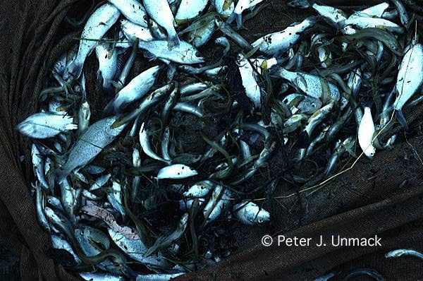 67KK jpeg
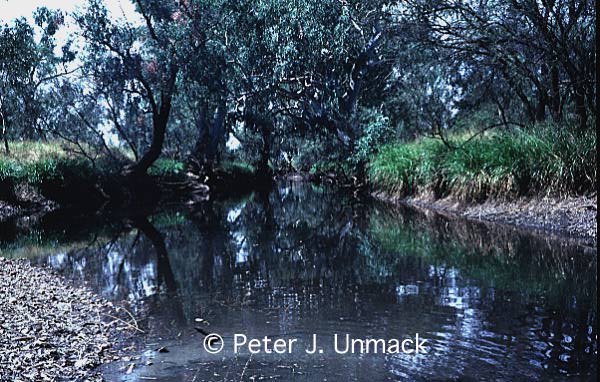 74KK jpeg
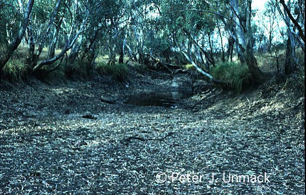 86KK jpeg
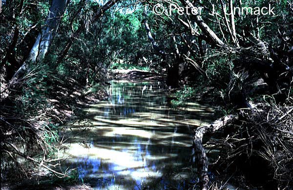 82KK jpeg
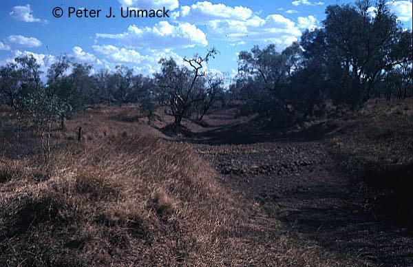 56KK jpeg
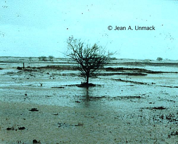 48KK jpeg
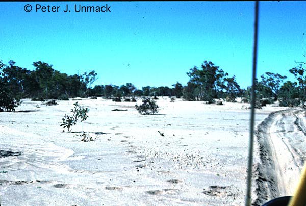 48KK jpeg
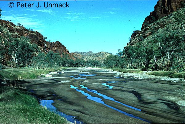 62KK
jpeg
62KK
jpeg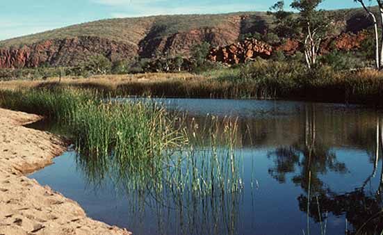 33KK
jpeg
33KK
jpeg 95KK jpeg
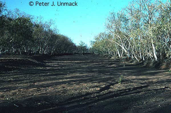 73KK jpeg